
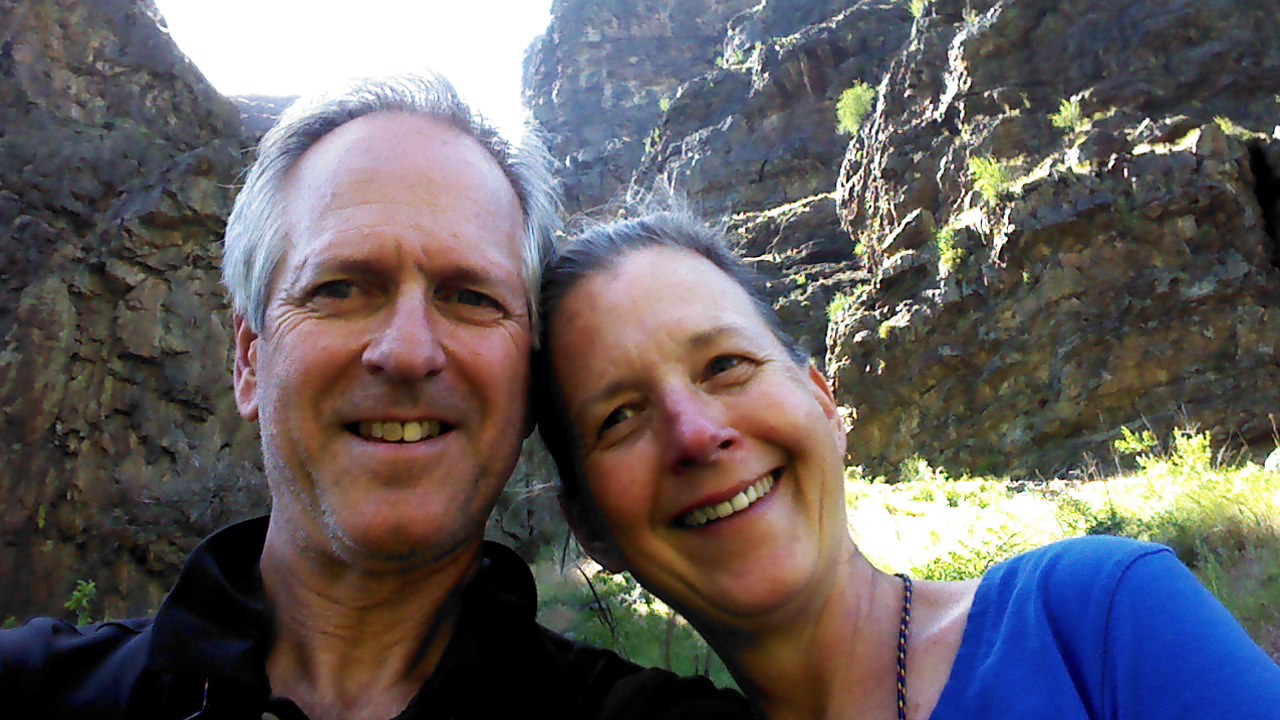
The hubster and I spent most of last week in Hells Canyon tent camping for the first time in decades. (It went well. Fantastic in fact, so we’ve decided to plan another trip.) While hiking on one of the trails through the gorge below the dam we got a wild hair and took a selfie…mainly because it’s the only possible way we were ever going to get a shot of both of us in the same frame. It was fun and, surprisingly, turned out halfway decent considering we’d been camping for four days with accompanying grime build-up.
Here it is.
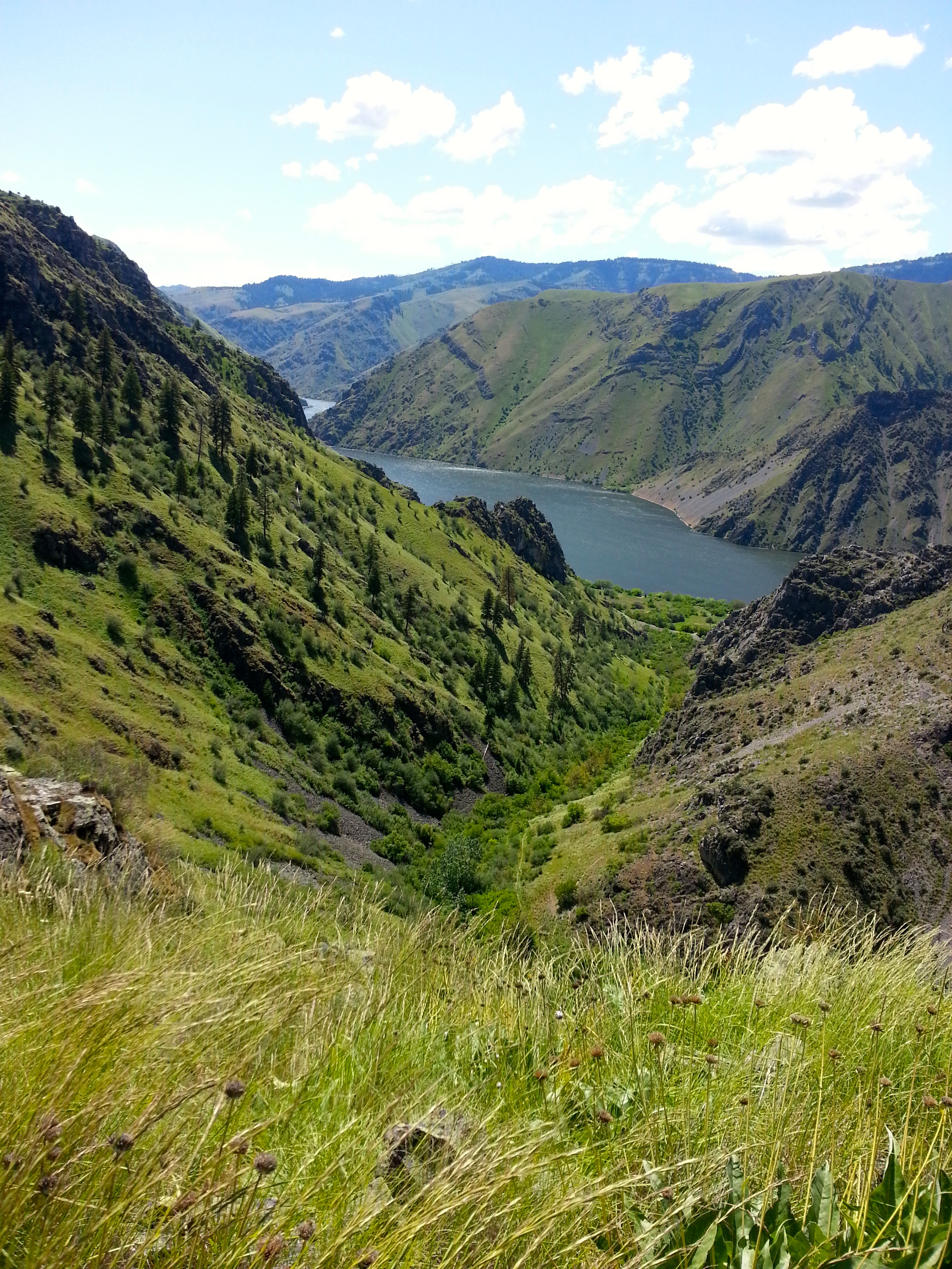
Truly though, the surrounding scenery looked better. For example:
The canyon
The snowcapped Wallowa Mountain range

A wild rugosa in bloom

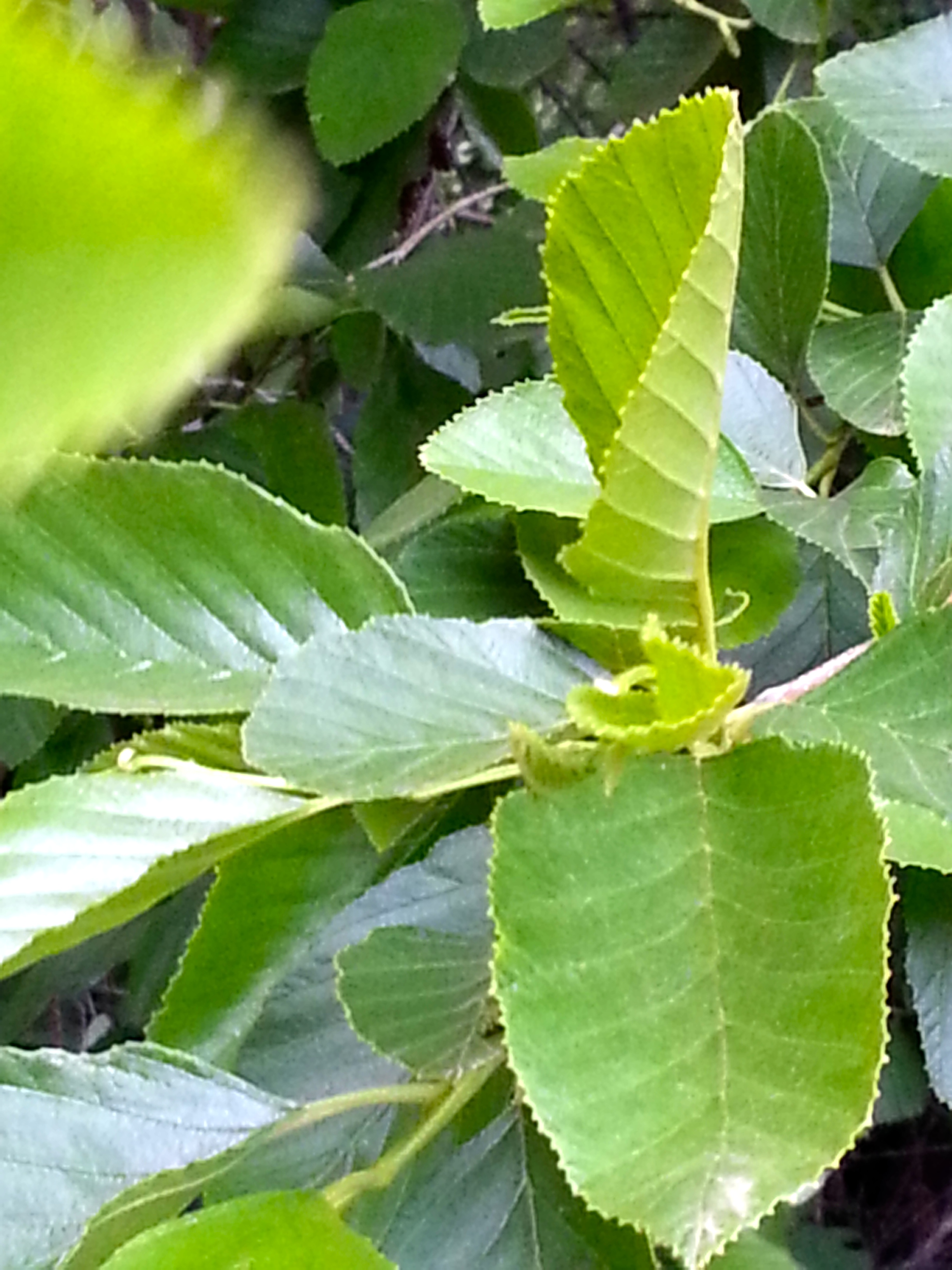
Cascara sagrada leaves (from the tree whose bark gives us the active ingredient in ExLax. Gaze and be grateful.)
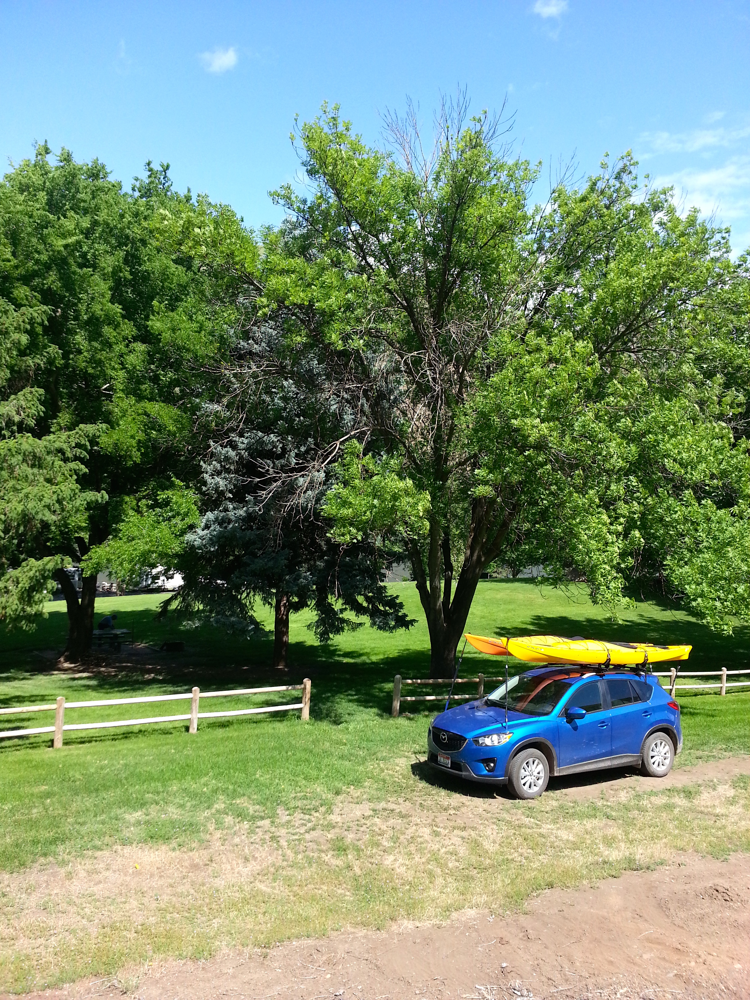
Our campsite (just prior to departure so sans tent, etc.) with Sherpa Pepe and the Kayak Twins
And an alpine rock garden on top of one of the many peaks
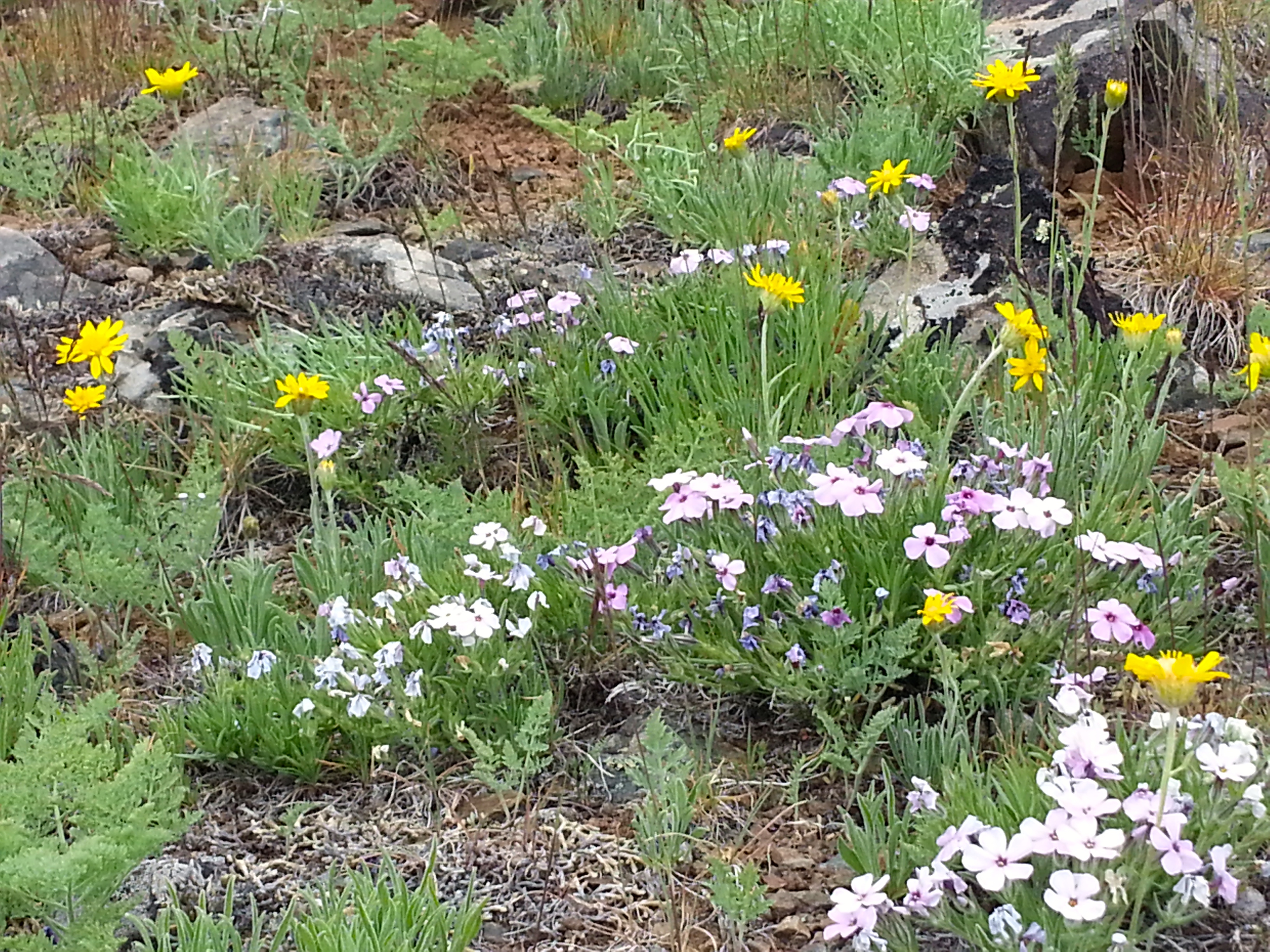
Did I mention it was wildflower season? It was wildflower season.
We also saw a couple of mountain goats, nesting bald eagles, and a brown bear but alas, being no wildlife photographer, I was unprepared and missed the opportunities. Oh, there were also bats. And a head full of ticks…no, two head fulls…but we were way too frantic trying to rip them out again to even think about taking pictures. No rattlesnake sightings though, even though the canyon is full of them, and thank God for that.
copyright Dia Osborn 2014

Dia, the photos are lovely. Where exactly is Hells Canyon?
Y’know I realized I was a little sparse on details about Hells Canyon after I posted. Sorry about that.
The Snake River marks the state borderlines between Oregon, southern Washington, and Idaho and Hells Canyon is a very deep gorge the river carved over the eons that runs for I think seventy miles or so…I’m not exactly sure what the official boundaries are of where it begins and ends. The river flows from south to north through the canyon and was dammed in three places at the beginning by the local power company. We camped next to the reservoir created by the third dam in order to do some flat water kayaking. Once you get past the dams the river is wild and only accessible by two roads (at 31 miles and 50-something miles) until it comes out of the canyon again somewhere near Moscow, Idaho. It gets really remote in there. It’s a favorite of white water rafters though and I’ve heard it takes something like four days to travel all the way through. There’s a lot of old pictographs and petroglyphs on rocks throughout the gorge from the earliest peoples who settled the canyon…some say as long as 12,000 years ago. The landscape there is spectacular and utterly fascinating. We’re pretty smitten. 🙂
My goodness the two of you have aged well. Cal is as handsome, if not more so and Dia you are just as I remember you from Arizona…a striking resemblance to a woman in my community who I’ve been trying to place and there she was, in you… like when those mysteries are solved. 🙂
My favorite pic was of the wild rugosa–my first acquaintance with that kind of flower. I did not know you were a photographer as well as a writer. So glad to see this post, and that of so many other bloggers I visit regularly, taking a breather from all the heavy stuff and just reveling in spring, prancing, leaping, cavorting.
Stellar shots, Dia. You both look too good to have been out in the wilderness for 4 days. I wouldn’t let a camera near me at that point! Thanks for the virtual camping trip.
Awesome!!!!
Sent from my iPad
>